Most Oregon backpackers chase snow-capped peaks and alpine lakes. The Oregon Badlands Wilderness, managed by the Bureau of Land Management 20 miles east of Bend, offers something entirely different: 29,000 acres of ancient lava flows, gnarled juniper, sagebrush desert, and a landscape so elemental it feels like a different planet. This is a wilderness that rewards the curious and punishes the unprepared, and it sees a fraction of the foot traffic of the Cascades.
What Makes the Badlands Unusual
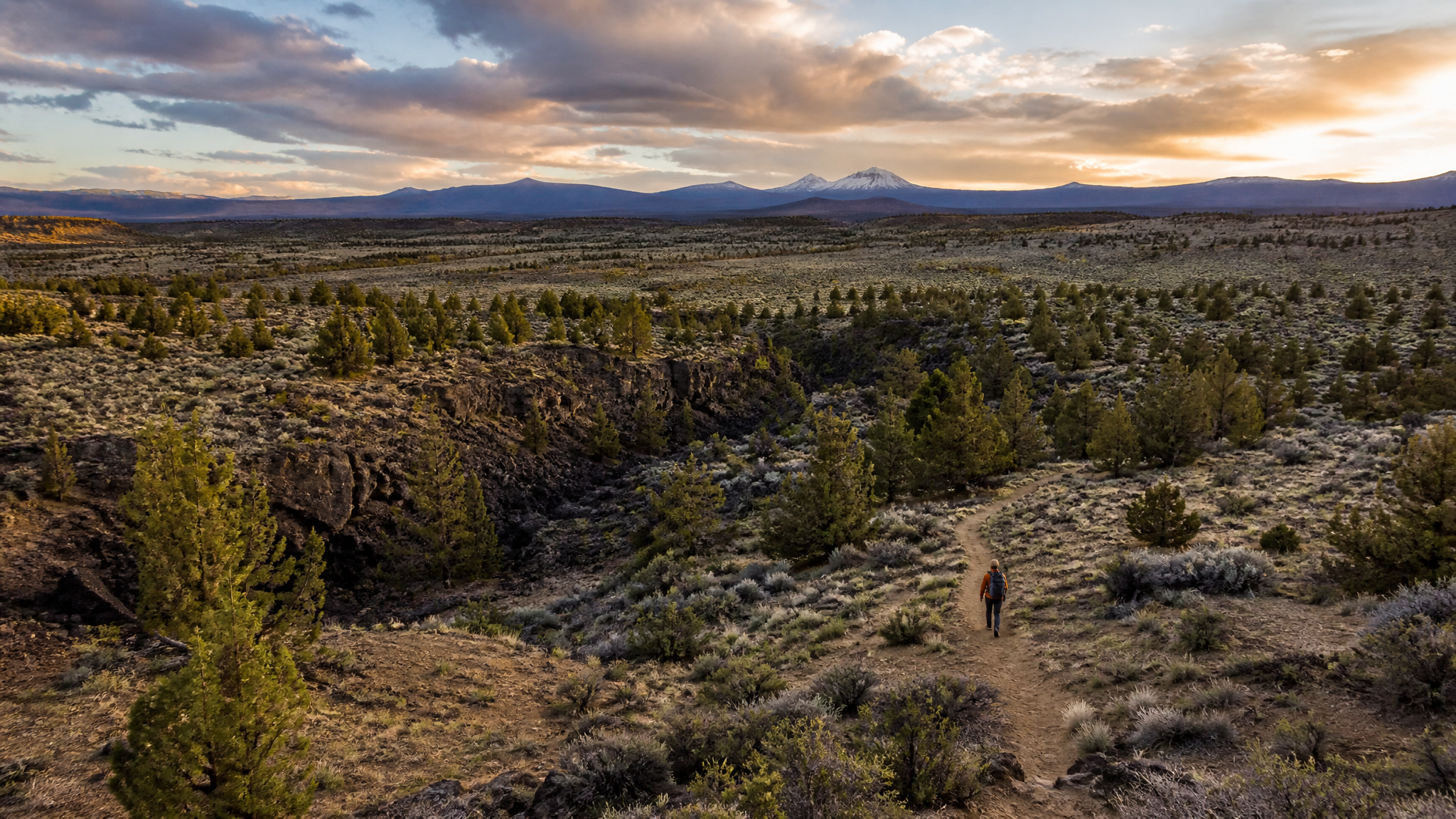
The Badlands sits atop a massive lava flow from the High Cascades eruptions roughly 80,000 years ago. The resulting terrain is a broken, uneven pahoehoe and aa surface softened over millennia by juniper, bitterbrush, rabbitbrush, and a remarkable diversity of high-desert bunchgrass. Ancient western juniper trees dominate — some of the largest and oldest in Oregon grow here, with gnarled trunks four and five feet across that date back 1,000+ years. The contrast of bright orange juniper bark against black lava rock and blue Central Oregon sky is striking in any season.
The area also contains lava tubes — collapsed or open remnants of ancient lava channels — and the undulating ridges of low lava rims that give the wilderness its name. Wildlife includes mule deer, pronghorn on the eastern edges, coyotes, golden eagles, and an impressive population of greater sage-grouse in the flatter bajada zones east of the main lava field.
The 2-Day Loop Route
The BLM manages several informal trailheads on the western and northern edges of the wilderness. The most accessible starting point is the Badlands Rock Trailhead off Highway 20, approximately 22 miles east of Bend (look for the BLM sign on the north side of the highway).
Day 1: Badlands Rock Trailhead to the Ancient Juniper Core (~8 miles)
From the trailhead, the main Badlands Rock Trail heads northeast into the juniper forest. The trail is well-marked with cairns through the first two miles, then transitions to fainter game trails across the open lava. Navigation skills matter here — download the BLM wilderness map on OnX or Gaia GPS before you go and mark waypoints at key junctions. Distances feel longer than they are due to the uneven terrain underfoot.
By mile 4, you’ll enter the old-growth juniper zone. Some of the trees here are so large and contorted they feel prehistoric. Camp in established sites away from the trees — the BLM asks that you use previously impacted areas to minimize further disturbance of the cryptobiotic soil crust. Nights out here are exceptional: with no light pollution and at 3,500 feet elevation, the Milky Way is overwhelming.
Day 2: Loop Return Through Lava Rim Country (~9 miles)
Head south and west along the higher lava rim sections, contouring back toward the trailhead via the eastern arm of the trail system. You’ll cross open lava benches with unobstructed views of the Three Sisters, Broken Top, Newberry Volcano, and on clear days, Mount Jefferson and Mount Hood on the northern horizon. The descent back to the trailhead follows a dry wash lined with sagebrush before returning to juniper forest in the final mile.
Carry a comprehensive paper map or downloaded offline GPS. Cell service is nonexistent in most of the wilderness.
Water: The Critical Planning Factor
There is no surface water in the Oregon Badlands Wilderness. None. Lava rock absorbs every drop of precipitation, and no springs exist within the designated wilderness boundary. You must carry all water from the trailhead.
For a 2-day loop in August, plan on 1 liter per hour of active hiking and additional cooking and camp water. A minimum of 4 liters per person at any point in the day is a reasonable baseline. In summer heat, that number goes up. Use a soft flask system or lightweight bladder to distribute weight across your pack. There are no resupply options.
Trail conditions in late August can be hot — daytime temperatures in the 80s to low 90s Fahrenheit are normal. Start hiking by 6:00 AM, take a midday break in juniper shade, and finish your miles by early afternoon. Afternoon thunderstorms are occasional in August; the open lava rims are exposed terrain in lightning.
Permits and Regulations
No permit is required to enter the Oregon Badlands Wilderness. Campfire restrictions apply in summer — check the Prineville BLM District’s current fire restrictions before your trip, as the lava terrain is extremely fire-prone and open fires may be prohibited from July through October. Carry a canister stove and leave-no-trace camping is expected throughout.
Dogs are permitted on-leash. The terrain is extremely hard on dog paws — bring booties or leave your dog at home for summer trips. Horses and stock animals are permitted with a high-clearance stock trailer and a permit obtained from the BLM Prineville District.
Best Times to Visit
- Late September – October: Ideal. Cooler temperatures, no water concerns beyond what you carry, migrating raptors and sage-grouse in peak numbers, extraordinary light on the old juniper.
- March – May: Desert wildflowers, comfortable temperatures, and the best light for photography on the lava benches.
- August: Doable with early starts and full water carries. Hot and exposed but uniquely beautiful in the golden late-summer light.
- December – February: Snow occasionally covers the lava field and transforms the landscape entirely. Cold camping but spectacular solitude.
The Oregon Badlands is not a trail runner’s checkbox. It’s a place that slows you down, makes you pay attention, and rewards the kind of hunter, angler, and outdoorsperson who notices that a 1,000-year-old juniper is worth standing in front of for a few minutes. Get out there before the crowds figure out what’s 20 miles east of Bend.