North America's Deepest Gorge, Oregon's Best-Kept Trail
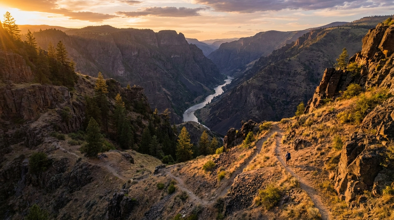
Most people know Hells Canyon from a jet boat ride or a glance over the rim at Hat Point. Few actually descend into it on foot. That's a shame, because the Snake River corridor in Hells Canyon National Recreation Area offers one of the most dramatic and rewarding backpacking experiences in the Pacific Northwest — and because access is difficult, the trails stay quiet even when everything else is crowded.
The Hat Point to Dug Bar route on the Oregon side is a point-to-point trip that drops nearly 6,000 feet from the rim to the river over roughly 24 miles of trail. It's hot, exposed, and demanding — and absolutely worth every step.
Route Overview: Hat Point to Dug Bar
- Distance: Approximately 24 miles one-way
- Elevation loss: ~6,000 ft descent (rim to river) with significant ups and downs
- Days: 4 days / 3 nights recommended
- Difficulty: Strenuous
- Best season: May–June and September–October (avoid July–August heat)
- Permit: No permit required; self-registration at trailhead
Getting There
Hat Point trailhead is reached via Forest Road 4240 out of Imnaha, Oregon. The last several miles are rough two-track — a high-clearance vehicle is strongly recommended. Dug Bar is the takeout point, also accessed from Imnaha. Arrange a shuttle or second vehicle at Dug Bar before you start.
Day-by-Day Itinerary
Day 1: Hat Point to Somers Creek (7 miles)
The trail begins at the Hat Point Lookout (elevation 6,982 ft) and immediately starts descending through ponderosa pine and bunchgrass. The views of the Snake River and Idaho's Seven Devils on the first descent are staggering. The trail alternates between rocky switchbacks and gentler traverses. Camp at Somers Creek, which typically has reliable water in May and June.
Day 2: Somers Creek to Saddle Creek (6.5 miles)
This is the most exposed section. The trail contours along steep canyon walls with big drop-offs and little shade. Watch your footing on the loose shale traverses. Saddle Creek drainage has a USFS primitive camp area with flat ground and access to creek water — treat all Hells Canyon water with a quality filter or UV purifier as cattle and wildlife share these drainages.
Day 3: Saddle Creek to Johnson Bar (5.5 miles)
The third day brings you close to the river corridor. You'll pass through zones of poison ivy (long pants strongly recommended) and through riparian areas lush with wildflowers in spring. Johnson Bar is a flat, sandy bench along the Snake — one of the most scenic camps in Hells Canyon. You may see jet boats passing, bighorn sheep on the rimrock, and white sturgeon rolling in the river below.
Day 4: Johnson Bar to Dug Bar (5 miles)
The final day follows the river closely along the Lower Snake River Trail. This section is relatively flat and easy compared to what came before. Dug Bar is a primitive takeout point with a boat ramp and parking area. Confirm your shuttle driver has a high-clearance vehicle — the access road demands it.
Water Sources
Water sources exist along the route but shouldn't be taken for granted. In May and June, Somers Creek and Saddle Creek run well. By late summer, some side creeks dry up entirely — carry capacity for 3–4 liters and always know your next source before leaving camp. The Snake River is always available but is silty; filter it through a quality device (Sawyer Squeeze or Katadyn BeFree) and consider chemical backup.
Wildlife and Hazards
- Rattlesnakes — Very common. Watch your step on rocky trails and never reach into a crevice without looking first.
- Bighorn Sheep — A highlight of any Hells Canyon trip. The resident population is visible most mornings on the steep basalt cliffs.
- Black Bears — Present in riparian areas. Hang food or use a bear canister at each camp.
- Poison Ivy — Grows aggressively in the lower canyon. Learn to identify it before you go.
- Heat — Canyon temperatures can exceed 100°F in summer. This trip is not safe in July or August without serious heat mitigation.
Gear Considerations
Pack for heat, not cold. In May and June, nights can dip to 40°F near the rim but the lower canyon stays warm — a 30°F bag is more than adequate. Trekking poles are essential on the steep, loose descent from Hat Point. Gaiters help with the dusty, gravelly surface. Wear broken-in, ankle-height hiking boots — this is ankle-twisting terrain and trail runners are not the right tool for this job.
Worth Every Step
Hells Canyon doesn't give itself up easily. The access is awkward, the terrain is demanding, and the heat can be punishing. But that's also why the trails stay empty and the experience is unforgettable. Dropping into the deepest gorge in North America on your own feet, camping on the bank of the Snake River with bighorn sheep above you and white sturgeon rolling below — that's the kind of trip that earns its place in your memory permanently. Put in the work to get there, and it'll pay you back a hundredfold.